
TerraYield 2: AI Analytics for Land Use and Crop Yield Prediction
Kick-off: July 21, 2026
The problem
Modern agriculture has access to more data than ever before, but that data is fragmented and disconnected.
Critical signals exist across multiple domains:
- Satellite imagery (land use, vegetation)
- Weather patterns (rainfall, temperature, seasonality)
- Commodity prices (market dynamics)
- Government agricultural reports
However, these data sources exist in separate silos, making it extremely difficult to:
- Understand how environmental and economic factors interact
- Track crop rotation and land-use changes over time
- Accurately predict regional crop yields
As a result:
- Forecasting models lack context
- Agricultural decisions are made with incomplete information
- Supply chain and food security risks increase
The project goals
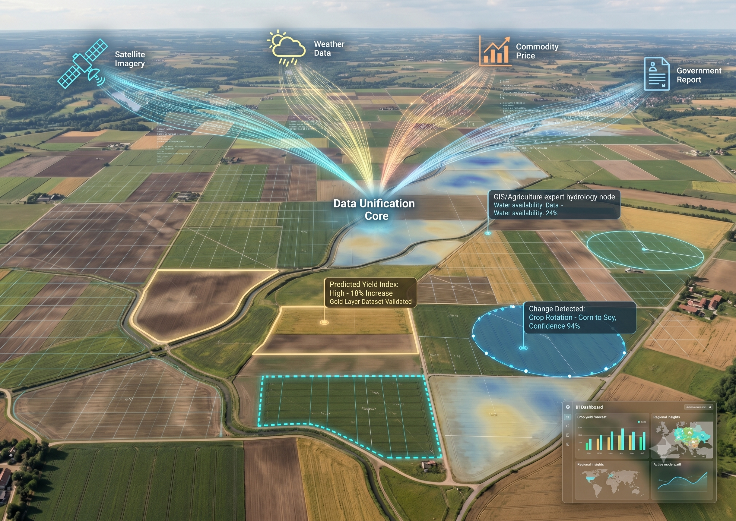
Building upon the initial dataset established in Phase 1, TerraYield 2 expands the data scope to encompass all available open-source data. This project proposes building a multi-modal agricultural intelligence system designed to unify satellite, environmental, and economic data into a single predictive framework.
The solution focuses on building a structured time-series dataset that enables advanced forecasting and land-use analysis.
Key components include:
- Validating the current Phase 1 dataset and establishing a newly upgraded schema
- Collecting and processing diverse, open-source satellite and spatial data
- Scraping weather data, commodity prices, and government reports
- Designing a unified time-series data architecture and structuring it to reach the gold layer
- Developing AI models for land-use detection and crop rotation analysis
- Building yield prediction models based on fused data
- Delivering an analytics dashboard for regional insights
As part of this challenge, the system must demonstrate the ability to:
- Integrate spatial (satellite) and temporal (weather, economic) data
- Align multi-source data into a consistent time-series structure
- Detect land-use changes and crop rotation patterns
- Predict regional crop yields with validated accuracy
- Capture relationships between environmental and economic variables
- Provide an intuitive interface for exploring agricultural trends
- Handle data gaps, noise, and inconsistencies across sources
Impact of the Problem
TerraYield Analytics can directly transform how agricultural decisions are made at scale.
Farmers & Agricultural Operators
- Better forecasting of crop yields before harvest
- Improved planning of planting cycles and crop rotation
- More informed decisions based on weather and market conditions
Governments & Policy Makers
- Early visibility into potential food shortages
- Data-driven agricultural policy and resource allocation
- Improved national and regional food security planning
Supply Chain & Commodity Markets
- More accurate forecasting of supply fluctuations
- Better anticipation of price volatility
- Improved logistics and inventory planning
AgriTech & Data Platforms
- Foundation for advanced agricultural intelligence systems
- High-value integrated datasets for future innovation
- Acceleration of multi-modal AI adoption in agriculture
Real-World Impact
- Reduced risk of food supply disruptions
- More efficient use of land and resources
- Stronger resilience to climate variability and market shocks
Timeline
Sprint 1 (Weeks 1-2)
Focus on current dataset validation and building the new schema for the dataset based on sample data collection with the new schema.
Sprint 2 (Weeks 3-4)
Data Synthesis & Integration. Focus on expansive open-source data collection, processing and merging streams to reach the gold layer of the integrated dataset.
Sprint 3 (Weeks 5-6)
Intelligence & Model Training. Developing land-use change detection and yield prediction models using GIS-aware ML architectures.
Sprint 4 (Weeks 7-8)
Visualization & Final Delivery. Building the Agricultural Analytics Dashboard and performing final accuracy testing for stakeholder review.
**More details will be shared with the designated team.
First Omdena Project?
- Join the Omdena community to make a real-world impact and develop your career
- Build a global network and get mentoring support
- Earn money through paid gigs and access many more opportunities
Your Benefits
- Address a significant real-world problem with your skills
- Get hired at top companies by building your Omdena project portfolio (via certificates, references, etc.)
- Access paid projects, speaking gigs, and writing opportunities
Requirements
- Good English
- A very good grasp in computer science and/or mathematics
- Understanding of Machine Learning, Web Scraping and/or GIS Analysis
Project partners

Related projects

TerraYield Analytics: AI for Land Use and Crop Yield Prediction
View project
AgriVision Global: AI for Real-World Crop Disease Detection
View project
Building CropLogic: AI-Powered Farming Intelligence for Smallholder and Medium Farms
View project