Flood Extent Mapping Using Computer Vision and Satellite Imagery
Challenge Started!

This Omdena Local Chapter Challenge runs for 4 weeks and is a unique experience to try and grow your skills in a collaborative and safe environment with a diverse mix of people from all over the world.
You will work on solving a local problem, initiated by the Omdena Islamabad, Pakistan Chapter.
The problem
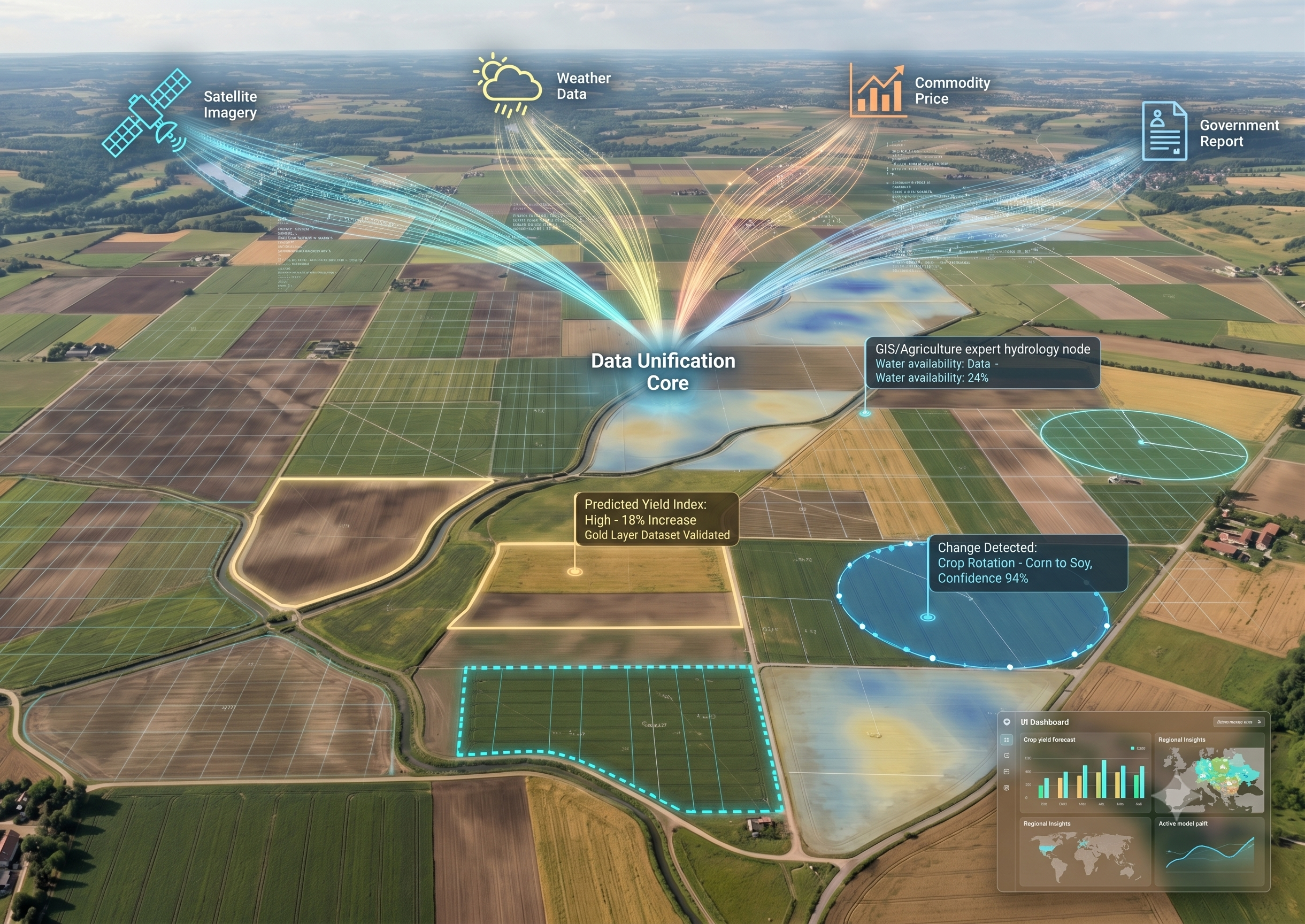
It is very critical to acquire timely information about which areas are flooded, so that disaster and relief agencies can speed up emergency response for relief and rescue measures and flood victims can migrate towards non-flooded areas. It is very difficult for people to visit the area and manually assess the impact of the affected areas. Hence, satellite imagery will be used instead, to generate flood extent mapping techniques that can be used to process images quickly, providing near real-time flooding information for damage assessment and relief activities.
The goals
- Analyzing and comparing the performance of our trained segmentation model against baseline models.
- Develop a model that can generate a flood extent map using temporally correlated satellite imagery.
- Provide insights into past performances of flood extent mapping.
- Dashboard showing real-time flood extent maps on the currently flooded areas of Pakistan and view time series of maps for past data
- Allow for newly found visualizations to assess the impacts of the currently flooded areas of Pakistan and track water recession over time
- Show extent maps generated with the segmentation model on the dashboard and possibilities of improvement with further research.
Why join? The uniqueness of Omdena Local Chapter Challenges
Omdena Local Chapter Challenges are not a competition or hackathon but a real-world project that will grow your experience to a new level.
A unique learning experience with the potential to make an impact through the outcome of the project. You will go through an entire data science project lifecycle. This covers problem scoping, data collection, and preparation, as well as modeling for deployment.
And the best part is that you will join the global and collaborative community of Omdena with tons of benefits to accelerate your career.
First Omdena Local Chapter Challenge?
- Beginner-friendly, but also welcomes experts
- Education-focused
- Open-source
- Duration: 4 to 8 weeks
Your Benefits
- Address a significant real-world problem with your skills
- Build your project portfolio
- Access paid projects (as an Omdena Top Talent)
- Get hired at top organizations
Requirements
- Good English
- Suitable for AI/ Data Science beginners but also more senior collaborators
- Learning mindset
This challenge is hosted with our friends at