Monitoring agricultural regions at scale remains a major challenge for organizations working in agriculture, food security, and climate resilience. Manual field inspections are often expensive, time-consuming, and difficult to scale across large farming regions.
To address these challenges, Omdena developed an interactive AI-powered crop monitoring and yield estimation platform that combines satellite imagery, NDVI analysis, geospatial intelligence, and machine learning to generate field-level agricultural insights.
The platform demonstrates how AI and satellite intelligence can support crop monitoring, vegetation analysis, yield estimation, farmland intelligence, and agricultural decision-making workflows.
Explore the Platform
The CropYield AI platform enables organizations to analyze farmland using satellite imagery and AI-powered agricultural intelligence workflows.
Users interested in exploring the platform can request access to the interactive demo.
How the Platform Works
The platform transforms satellite imagery into actionable agricultural insights through a simple geospatial workflow.
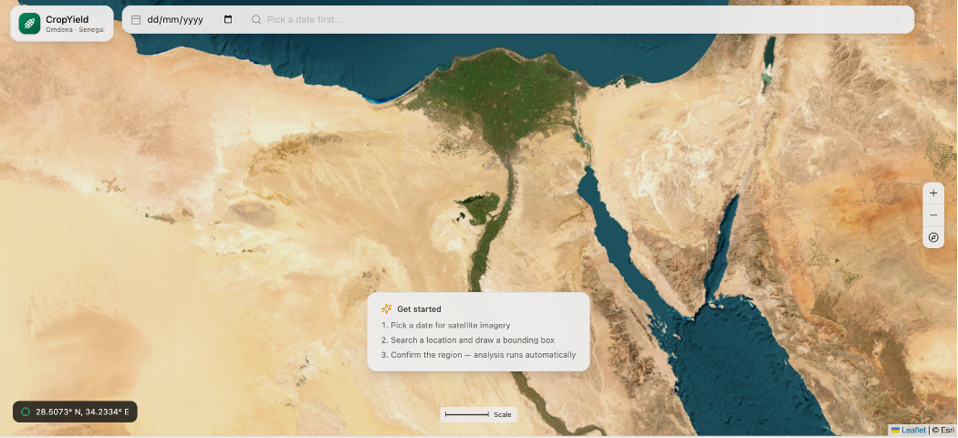
Step 1 — Select a Location & Date
Users can search agricultural regions and select the desired satellite imagery timeframe for analysis. This enables large farming areas to be monitored remotely without requiring physical field inspections.
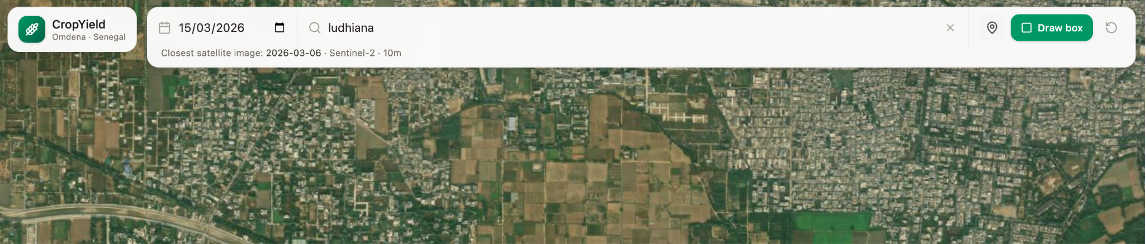
Step 2 — Define the Area of Interest
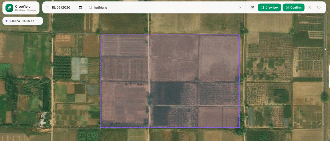
Using the interactive GIS interface, users can draw a boundary around farmland or agricultural regions directly on the map. The platform enables field-level agricultural analysis through an intuitive visual workflow.
Step 3 — Run AI-Powered Analysis
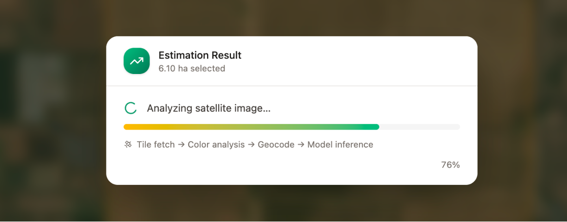
The system processes the selected farmland using satellite imagery, NDVI-based vegetation analysis, environmental data, and machine-learning models. This workflow enables scalable agricultural assessment without requiring physical field inspections.
Step 4 — Generate Agricultural Insights
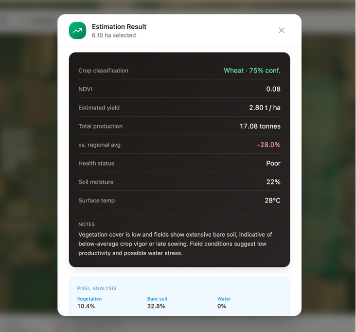
The platform generates insights such as estimated crop yield, vegetation health analysis, soil moisture indicators, surface temperature analysis, and vegetation coverage assessment. These insights help organizations better understand field conditions and agricultural productivity remotely.
Using NDVI for Crop Health Monitoring
One of the core technologies behind the platform is NDVI (Normalized Difference Vegetation Index), which is commonly used in remote sensing applications to evaluate vegetation health and density.
The platform uses NDVI analysis to help identify:
- healthy vegetation
- stressed crops
- low-productivity farmland
- bare soil regions
- water-covered areas
By combining satellite imagery with vegetation intelligence, organizations can better understand crop conditions remotely and at scale.
Key Features of the Platform
The platform combines satellite intelligence and geospatial AI to support scalable agricultural analysis workflows.
1. Satellite-Based Agricultural Monitoring
Monitor farmland remotely using satellite imagery and geospatial analysis.
2. AI-Powered Yield Estimation
Estimate agricultural productivity using machine learning models and environmental data.
3. Interactive GIS Mapping
Analyze agricultural regions directly through an interactive geospatial interface.
4. Vegetation & Land Analysis
Identify stressed farmland, vegetation density, and environmental conditions.
5. Soil & Environmental Insights
Generate insights related to soil moisture, surface temperature, vegetation conditions, and environmental variability.
Real-World Applications
The platform supports a wide range of agricultural and environmental use cases.
Food Security Monitoring
Monitor agricultural productivity across large geographic regions to support food security initiatives.
Precision Agriculture
Enable data-driven agricultural decision-making using satellite intelligence and AI analysis.
Government & NGO Programs
Support rural development and agricultural monitoring initiatives at scale.
Climate & Environmental Analysis
Track vegetation stress and environmental conditions affecting farmland.
Agricultural Risk Assessment
Support crop monitoring and forecasting workflows for agricultural risk analysis.
Technology Behind the Platform
The platform combines geospatial AI, satellite imagery, and machine learning technologies to generate agricultural insights from remote sensing data.
Key technologies used in the platform include:
- Satellite Imagery
- Remote Sensing
- NDVI Analysis
- GIS Mapping
- Machine Learning
- Geospatial AI
- Environmental Data Processing
- Yield Prediction Models
Explore AI-Powered Agricultural Intelligence
Organizations interested in exploring the platform can request access to the interactive demo and learn how AI-powered agricultural intelligence can support their workflows.
The platform demonstrates how AI and satellite intelligence can support crop monitoring, yield estimation, vegetation analysis, farmland intelligence, and agricultural decision-making workflows.